Serengeti
Serengeti Endless Plains
Visitors to the park would often ask about the origin of the beautiful word ‘Serengeti’. It is definitely a Maasai name, but it has been changed by both Swahili and English. Originally it was Siringet, but the English rendered it Serenget and the Kiswahili language added the final ‘i’.
The word itself appears to be taken from Siringitu Meaning ‘tending to extend’, and is closely related another Maasai word ‘siriri’ Meaning straight or elongated. Either way, the sense of space is clear: the place where the land runs on for ever.
The most iconic World Heritage Site (WHS) and International Biosphere Reserve (IBR) in the twenty-first century. Only Serengeti National Park and the Ngorongoro Conservation Area carry both the WHS and IBR designations.
The Serengeti is defined by the area across which the wildebeest migrate. The Park was created so that the last remaining great herds of grassland animals in Africa should be protected within its borders all the year round.
Serengeti, initially known for its lions in the 1920s, only became famous for the great migration of wildebeest and zebra in the 1960s.
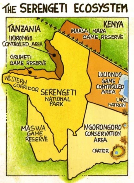
Serengeti National Park is at the heart the larger Serengeti ecosystem, which is defined by the area covered by the annual migration. The property is contiguous with Ngorongoro Conservation Unit, an area of 528,000ha declared a World Heritage Site in 1979. The entire ecosystem also includes the Maswa Game Reserve (2,200km2) in the south, Grumeti and Ikorongo Game Reserves in the east, Maasai Mara National Reserve in Kenya (1,672km2) to the north, and Loliondo Game Controlled Area in the west. This entire ecosystem is intact and no barriers hamper the migration.
Serengeti is near the equator, lying just two degrees south.
As the Serengeti National Park is nearly as big as Kuwait or Northern Ireland no one, in a single visit, can hope to see more than a small part of it. If time is limited a trip round. the Seronera valley, with opportunities to see lion and leopard, is probably the most enjoyable.
It supports more large mammal species than any other place in the world, and almost as many bird species as the whole of Europe.
Although Serengeti is now famous for its iconic migration of ungulate herds, the world was not even aware of it until as late as 1960, when Professor Bernhard Grzimek and his son, Michael, made the film Serengeti Shall Not Die. Before this, Serengeti was known only by hunters as a place to shoot magnificent, black- maned lions, first attracted attention, in the 1920s foreign hunting expeditions camped at the edge of the plains on the Seronera River because there were so many lions in the vicinity. It was the extermination of lions that led to the first small part of Serengeti becoming a protected area in 1930.
Hunters and wardens alike, from the 1930s to the 1950s, were aware of the ungulate herds as they appeared on the plains in the wet season, but had no idea where they went after they left in May. In Kenya, the reverse was true: in 1913, game rangers there saw the herds appear on the Mara River in the dry season and then dis appear somewhere into Tanzania, but did not know where.
So it was not until the Grzimeks did their first surveys by plane, in the late 1950s, that we had some rough idea where the animals went (approximate because there were no maps). Then, in 1962, Murray Watson arrived as part of a United Nations– sponsored research program through the Food and Agriculture Organization. He was the first person to record the areas that the mi grants used in diferent seasons.
The Lion, the ‘King of the Jungle’, is a keystone species, its populations reflecting the general health of the environment. Although Lion are apex predators (i.e. they are at the top of the food chain), their numbers have decreased significantly in Africa over the past 60 years, from an estimated 400,000 in the 1950s to just 20,000 today.
There are estimated to be approximately 15,000 Lions in Tanzania. While still is the largest population in Africa, this figure is significantly less than it was just two decades ago. The highest numbers are in the Selous ecosystem followed by Serengeti NP, which has around 3,000 Lions.
More info on the Lions of Serengeti.
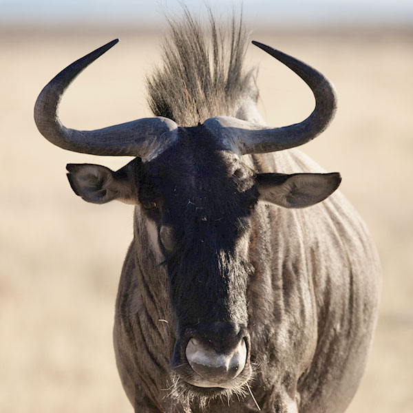
Tanzania has approximately 80% of the world’s population of Common Wildebeest. The population in the Serengeti ecosystem increased substantially in number from 220,000 in 1961 to around 1·4 million in the 1970s following the elimination of the Rinderpest disease through a cattle vaccination programme.
1850
Maasai arrive from Kenya
1890
The decade of the 1890s was a disaster for Maasai on the Serengeti plains, struck first by rinderpest, which resulted in famine and smallpox. The starving peoples emigrated and were captured by other tribes. The next decade saw civil war between three family groups, exacerbated through restrictions imposed by the Germans, at the end of which the population was almost wiped out. However, during the First World War, when the Germans were on the run, the Maasai began to re-establish their lost ground. Even in 1905 warriors ventured west, establishing temporary barracks at Moru Kopjes from which to raid the Wasukuma further west. The Maasai never set up permanent camps west of Olduvai, even in the twentieth century.
1904
Anglo-German boundary commission established the border between British East Africa (Kenya) and German East Africa (Tanzania) which crossed the northern Serengeti.
1914
Leslie Simpson pioneered the route for vehicles from Nairobi via Narok south through the northern Serengeti to what is now Seronera.”
1919
Great Britain assumes control over Tanzania after WW1
1921
The British colonial administration established a partial game reserve of 800 acres (3.2 km2) to protect the area’s declining lion population.
1929
-The park was officially named Serengeti National Park and the area was expanded to 2286 sq. Km, the area being the current southern Serengeti today.
-Serengeti now being a ‘Closed Reserve’ ,sport hunting was allowed with a special licence
-90 square miles a section of what is now the central Serengeti, including Seronera, was made a full game reserve and it was at about this time that the Serengeti become world famous for its lions
Denys Finch-Hatton, was credited with the creation of Serengeti as a wildlife conservation area, as he raised awareness of massacres of lions
Major Monty Moore as the first game warden signalled the beginning of Serengeti as a protected area for conservation and the end of the free-for-all massacres of lions.
1937
-Moore worked at getting protection for lions, all hunting activities were banned due to high numbers of lions and elephants being killed
-A 900-square-mile area was declared the ‘Serengeti Game Sanctuary’. The boundaries were between the Mbalageti and Grumeti rivers as far as Speke Gulf in the west—what we now call the ‘corridor’—and along the old road to Naabi in the east from Banagi to about Lake Magadi.
-The colonial government announced its intention to create a national park.
1940
-The Serengeti National Park was formally declared, the Tanganyika government established a system of national parks, including Serengeti.
-A protected area status was granted to the reserve. At this time the present Ngorongoro Conservation Unit was part of the new Park, being known as Eastern Serengeti.
And the Loliondo district as far north as the Kenya border and east to the edge of the Gregory rift valley
-No action was taken due to distractions of the 2nd world until 1951.
1948
The Serengeti National Park Board of Trustees was formed to administer the park and grant it strict protection.
1951
– The boundaries were finally agreed after much discussion and the park proclaimed on 1 June 1951.”
-Tanganyika’s first national park was now established, which also included the Ngorongoro Crater.
-Covering Southern Serengeti and what is now the Ngorongoro Conservation Area
-Ngoronoro Crater being the park headquarters
-Serengeti now covering 3200 square miles (8,300 square kilometers)
1954
- There were 194 Maasai who lived in the Gol Mountains but used the western plains on a seasonal basis. Since the mid-1930s Maasai from the Gol Mountains had developed a seasonal grazing pattern: as the wildebeest left the western plains in June or July the Maasai followed them to the edge of the plains along the Ngare Nanyuki River in the north and towards Moru in the west to make use of spring water. They used these areas for some three months until the wildebeest returned in November, whereupon they retreated back to the Gol Mountains. This ebb and flow was constrained by ecological factors, namely tsetse fly, which prevented their further movement into the savanna, and the malignant catarrh fever carried by wildebeest, which caused the Maasai to move east again at the start of the rains.
•⁃In the Ngorongoro Crater: there were over 200 families, of which 82 were Masai, established on the floor of the Ngorongoro Crater, growing maize and tobacco, diverting streams for irrigation and destroying vegetation. Apart from the Masai, none of these new arrivals could claim traditional rights of occupancy in the Park, and in 1954 their activities were banned. By the end of the year almost all the cultivation in the Park had ceased and most of the crop growers had been re-settled elsewhere.
1955
In the Moru Kopjes in the Western Serengeti there were also nearly 100 families of Ndorobo with 10,000 head of cattle and 8,000 head of small stock. Unlike the Masai, who used this area seasonably, the Ndorobo had established permanent bomas, from which they took a steady toll of game with poisoned arrows. As a result of pressure from the Park authorities, the Administration and the Masai elders, the Ndorobo were forced to leave the Park in March 1955 and settle elsewhere.
1956
-The problem was where to draw the boundaries. To decide these boundaries one needed information on both the location of pastoralists and the movements of the migrating wildlife herds about which almost nothing was known
-No one at that time had any idea where these migrating animals came from or where they went.
- A commission of enquiry employed Professor Pearsall to make the study. He reported that there were two groups of migrating wildebeest, one from the Ngorongoro Crater that moved onto the eastern Serengeti plains in the wet season, and one from the corridor that used the western plains. In between the two there was a gap not used by either, a gap that could conveniently be used for the boundary of the new Serengeti National Park. This advice was accepted and the new boundary running north–south across the middle of the plains was legislated in 1959 (Map 2). The information that Pearsall used was more hearsay than fact and was incorrect—the Ngorongoro wildebeest never went onto the eastern plains but remained on the highlands or in the Crater itself. Instead the main migratory wildebeest of Serengeti used the whole of the plains including the Salai plains at the far eastern edge of the Gregory rift valley. Since the new boundary alignment the migratory wildebeest have moved outside the Serengeti National Park each year during the wet season. These movements have caused a confrontation with the Maasai because wildebeest carry malignant catarrh fever, a disease that kills cattle. Maasai herds move away from the plains when the wildebeest are there.
1958
In 1958 Bernard and Michael Grzimek were invited by the Director of National Parks, P. G. Molloy, to conduct the first wildlife survey of the Serengeti ecosystem. Part of their work documented the movements of the migrants and they showed up the fallacy in Pearsall’s report. However, by this time it was too late and the boundaries had been settled despite strong protests from the Grzimeks.
1959
-Serengeti was separated from the Ngorongoro Conservation Area and established as its own national park.
-Serengeti boundaries were expanded to the Kenyan border to the North.
The Maasai were all migrated into the Ngorongoro Conservation Area, this meant that the Maasai can live and graze their cattle in NCAA but not in Serengeti
-The northern extension—the whole area north of the Orangi River to the Mara River—was added, because this area had never had inhabitants due to the presence of tsetse fly; no people were moved out. It was a remarkable stroke of luck, perhaps the greatest piece of luck in conservation history, because this area turned out to be the essential dry season refuge for the migration, indeed the most important area of the whole ecosystem—without it the migration would have collapsed and the Serengeti reduced to just another sample of savanna with resident animals.
-Bernard Grzimek’s distribution maps showed the animals moving north but far to the west and he opposed this addition because it appeared unused by the migration—his maps were simply too inaccurate and he misplaced the migration routes.
-When the NCA was created they decided to fence the western entrance of the Angata Kiti valley in the Gol Mountains so as to exclude the wildebeest and keep the area for cattle. When the wildebeest and zebra migration arrived on the plains in 1960 they went straight into the fence, several hundred thousand at once, and the fence fell over. Sensibly they did not try to put the fence up again.
-Serengeti now covering an area of 5,335 square miles (13,818 square km)
1961
The Maasai Mare Game Reserve was established
1962
Maswa Game Reserve was established
1965
The Lamai wedge was added to Serengeti, between the Mara River and Kenyan Border thus creating a continuous protected corridor for the wildebeest migration from the Serengeti plains in the south to the Loita plains in the north.”
1967
-The Grumeri River in the western corridor was added
-Lamai wedge adjoining the Tanzania-Kenya border and a strip north of the Grumeti river in the western ‘corridor’ which, taken together, amount to a further 945 square kilometres.
-Serengeti now covering an area of 5,700 square miles (14,763 square km)
1972
Serengeti was among the first places to be proposed as a World Heritage Site by UNESCO at 1972 Stockholm conference.
1981
Serengeti National Park was Gazetted as a UNESCO world heritage site it was voted the most important natural area in the world along with the Ngorongoro Conservation Area
1993
Grumeti and Ikorongo Game reserves were established
2003
Wildlife Management Areas were decreed
History of
The Serengeti
Timeline
1850
Maasai arrive from Kenya
1890
The decade of the 1890s was a disaster for Maasai on the Serengeti plains, struck first by rinderpest, which resulted in famine and smallpox. The starving peoples emigrated and were captured by other tribes. The next decade saw civil war between three family groups, exacerbated through restrictions imposed by the Germans, at the end of which the population was almost wiped out. However, during the First World War, when the Germans were on the run, the Maasai began to re-establish their lost ground. Even in 1905 warriors ventured west, establishing temporary barracks at Moru Kopjes from which to raid the Wasukuma further west. The Maasai never set up permanent camps west of Olduvai, even in the twentieth century.
1904
Anglo-German boundary commission established the border between British East Africa (Kenya) and German East Africa (Tanzania) which crossed the northern Serengeti.
1914
Leslie Simpson pioneered the route for vehicles from Nairobi via Narok south through the northern Serengeti to what is now Seronera.”
1919
Great Britain assumes control over Tanzania after WW1
1921
The British colonial administration established a partial game reserve of 800 acres (3.2 km2) to protect the area’s declining lion population.
1929
-The park was officially named Serengeti National Park and the area was expanded to 2286 sq. Km, the area being the current southern Serengeti today.
-Serengeti now being a ‘Closed Reserve’ ,sport hunting was allowed with a special licence
-90 square miles a section of what is now the central Serengeti, including Seronera, was made a full game reserve and it was at about this time that the Serengeti become world famous for its lions
Denys Finch-Hatton, was credited with the creation of Serengeti as a wildlife conservation area, as he raised awareness of massacres of lions
Major Monty Moore as the first game warden signalled the beginning of Serengeti as a protected area for conservation and the end of the free-for-all massacres of lions.
1937
-Moore worked at getting protection for lions, all hunting activities were banned due to high numbers of lions and elephants being killed
-A 900-square-mile area was declared the ‘Serengeti Game Sanctuary’. The boundaries were between the Mbalageti and Grumeti rivers as far as Speke Gulf in the west—what we now call the ‘corridor’—and along the old road to Naabi in the east from Banagi to about Lake Magadi.
-The colonial government announced its intention to create a national park.
1940
-The Serengeti National Park was formally declared, the Tanganyika government established a system of national parks, including Serengeti.
-A protected area status was granted to the reserve. At this time the present Ngorongoro Conservation Unit was part of the new Park, being known as Eastern Serengeti.
And the Loliondo district as far north as the Kenya border and east to the edge of the Gregory rift valley
-No action was taken due to distractions of the 2nd world until 1951.
1948
The Serengeti National Park Board of Trustees was formed to administer the park and grant it strict protection.
1951
– The boundaries were finally agreed after much discussion and the park proclaimed on 1 June 1951.”
-Tanganyika’s first national park was now established, which also included the Ngorongoro Crater.
-Covering Southern Serengeti and what is now the Ngorongoro Conservation Area
-Ngoronoro Crater being the park headquarters
-Serengeti now covering 3200 square miles (8,300 square kilometers)
1954
- There were 194 Maasai who lived in the Gol Mountains but used the western plains on a seasonal basis. Since the mid-1930s Maasai from the Gol Mountains had developed a seasonal grazing pattern: as the wildebeest left the western plains in June or July the Maasai followed them to the edge of the plains along the Ngare Nanyuki River in the north and towards Moru in the west to make use of spring water. They used these areas for some three months until the wildebeest returned in November, whereupon they retreated back to the Gol Mountains. This ebb and flow was constrained by ecological factors, namely tsetse fly, which prevented their further movement into the savanna, and the malignant catarrh fever carried by wildebeest, which caused the Maasai to move east again at the start of the rains.
•⁃In the Ngorongoro Crater: there were over 200 families, of which 82 were Masai, established on the floor of the Ngorongoro Crater, growing maize and tobacco, diverting streams for irrigation and destroying vegetation. Apart from the Masai, none of these new arrivals could claim traditional rights of occupancy in the Park, and in 1954 their activities were banned. By the end of the year almost all the cultivation in the Park had ceased and most of the crop growers had been re-settled elsewhere.
1955
In the Moru Kopjes in the Western Serengeti there were also nearly 100 families of Ndorobo with 10,000 head of cattle and 8,000 head of small stock. Unlike the Masai, who used this area seasonably, the Ndorobo had established permanent bomas, from which they took a steady toll of game with poisoned arrows. As a result of pressure from the Park authorities, the Administration and the Masai elders, the Ndorobo were forced to leave the Park in March 1955 and settle elsewhere.
1956
-The problem was where to draw the boundaries. To decide these boundaries one needed information on both the location of pastoralists and the movements of the migrating wildlife herds about which almost nothing was known
-No one at that time had any idea where these migrating animals came from or where they went.
- A commission of enquiry employed Professor Pearsall to make the study. He reported that there were two groups of migrating wildebeest, one from the Ngorongoro Crater that moved onto the eastern Serengeti plains in the wet season, and one from the corridor that used the western plains. In between the two there was a gap not used by either, a gap that could conveniently be used for the boundary of the new Serengeti National Park. This advice was accepted and the new boundary running north–south across the middle of the plains was legislated in 1959 (Map 2). The information that Pearsall used was more hearsay than fact and was incorrect—the Ngorongoro wildebeest never went onto the eastern plains but remained on the highlands or in the Crater itself. Instead the main migratory wildebeest of Serengeti used the whole of the plains including the Salai plains at the far eastern edge of the Gregory rift valley. Since the new boundary alignment the migratory wildebeest have moved outside the Serengeti National Park each year during the wet season. These movements have caused a confrontation with the Maasai because wildebeest carry malignant catarrh fever, a disease that kills cattle. Maasai herds move away from the plains when the wildebeest are there.
1958
In 1958 Bernard and Michael Grzimek were invited by the Director of National Parks, P. G. Molloy, to conduct the first wildlife survey of the Serengeti ecosystem. Part of their work documented the movements of the migrants and they showed up the fallacy in Pearsall’s report. However, by this time it was too late and the boundaries had been settled despite strong protests from the Grzimeks.
1959
-Serengeti was separated from the Ngorongoro Conservation Area and established as its own national park.
-Serengeti boundaries were expanded to the Kenyan border to the North.
The Maasai were all migrated into the Ngorongoro Conservation Area, this meant that the Maasai can live and graze their cattle in NCAA but not in Serengeti
-The northern extension—the whole area north of the Orangi River to the Mara River—was added, because this area had never had inhabitants due to the presence of tsetse fly; no people were moved out. It was a remarkable stroke of luck, perhaps the greatest piece of luck in conservation history, because this area turned out to be the essential dry season refuge for the migration, indeed the most important area of the whole ecosystem—without it the migration would have collapsed and the Serengeti reduced to just another sample of savanna with resident animals.
-Bernard Grzimek’s distribution maps showed the animals moving north but far to the west and he opposed this addition because it appeared unused by the migration—his maps were simply too inaccurate and he misplaced the migration routes.
-When the NCA was created they decided to fence the western entrance of the Angata Kiti valley in the Gol Mountains so as to exclude the wildebeest and keep the area for cattle. When the wildebeest and zebra migration arrived on the plains in 1960 they went straight into the fence, several hundred thousand at once, and the fence fell over. Sensibly they did not try to put the fence up again.
-Serengeti now covering an area of 5,335 square miles (13,818 square km)
1961
The Maasai Mare Game Reserve was established
1962
Maswa Game Reserve was established
1965
The Lamai wedge was added to Serengeti, between the Mara River and Kenyan Border thus creating a continuous protected corridor for the wildebeest migration from the Serengeti plains in the south to the Loita plains in the north.”
1967
-The Grumeri River in the western corridor was added
-Lamai wedge adjoining the Tanzania-Kenya border and a strip north of the Grumeti river in the western ‘corridor’ which, taken together, amount to a further 945 square kilometres.
-Serengeti now covering an area of 5,700 square miles (14,763 square km)
1972
Serengeti was among the first places to be proposed as a World Heritage Site by UNESCO at 1972 Stockholm conference.
1981
Serengeti National Park was Gazetted as a UNESCO world heritage site it was voted the most important natural area in the world along with the Ngorongoro Conservation Area
1993
Grumeti and Ikorongo Game reserves were established
2003
Wildlife Management Areas were decreed
Serengeti-Mara ecosystem lost an estimated 40 percent of its original area (approx. 30,143 sq. km in 1910) by the 1990s.
The Serengeti ecosystem spans about 35,000 square kilometers (13,500 square miles), its extent is defined by the movements of the migratory wildebeest.
Core Protected Areas: ~24,565 km² (9,482 mi²) and Buffer Areas: ~11,000 km² (4,247 mi²).
The political administrations included: the main ones in Tanzania are the Serengeti National Park (SNP) itself, and the Conservation Area (NCA), which lies east of the park and includes half of the Serengeti plains. North of the NCA is the district of Loliondo. The Maasai Mara Reserve is the main Kenyan administration. This area holds the vital dry- season grazing and water supplies for the migration. South and west of SNP are small game reserves, such as Maswa, Grumeti, and Ikorongo
There are three major rivers, the most important being the Mara, which originates in the montane forests of the Mau Highlands of Kenya. It has until recently flowed year round, providing the main water supply for the great herds of migrating animals in the dry season. It flows through the Mara Reserve of Kenya and northern Serengeti, and eventually flows west through the huge Musiara swamp into Lake Victoria at Musoma. The two other rivers are the Grumeti, which originates in the highlands of northeastern Serengeti, and the Mbalageti, which originates on the Serengeti plains. Both are seasonal rivers with only pools remaining in the dry season. All other rivers dry out except for a few springs that seep from the base of hills.
Steep, rocky hills occur along the eastern boundary of SNP and between the Grumeti and Mbalageti rivers in the west, forming a backbone to the corridor between the rivers. The Nyaraboro Plateau, with a high (300- meter) escarpment, occurs in the southwest. Because of the generally higher elevation in the east, the hills in Loliondo and the northeast of SNP reach 2,000 meters.
The Serengeti ecosystem is (very roughly) a square, with the treeless plains covering the bottom right quarter, about 5,000 sq. kilometers. They were formed by dust deposits from the volcanoes of the Crater Highlands 4 million years ago.
The ecosystem is effectively self- contained, enclosed by natural boundaries on all but one side. The eastern boundary is formed by the escarpment of the Gregory Rift and the base of the Crater Highlands.
The south is bounded by the edge of the Serengeti plains and in Maswa by the appearance of numerous kopjes (rocky outcrops).
In the west, the corridor, which is largely an alluvial plain formed by the rivers, is bounded on both its south and north by higher ground now agricultural land and by Speke Gulf.
The west side of the northern extension of Serengeti to the Kenya border is an artificial boundary set by agriculture. Within Kenya, the Mara Reserve is bounded by the Isuria escarpment, the Loita plains, and the Loita hills.
The Serengeti ecosystem supports twenty-eight ungulates together with ten large carnivores that eat them. This is an extraordinarily rich and diverse ungulate community. How can all these species coexist with the wildebeest, which outnumbers them all put together and is so dominant that this one ruminant grazer defines the whole ecosystem?
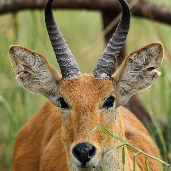
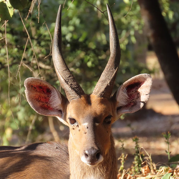
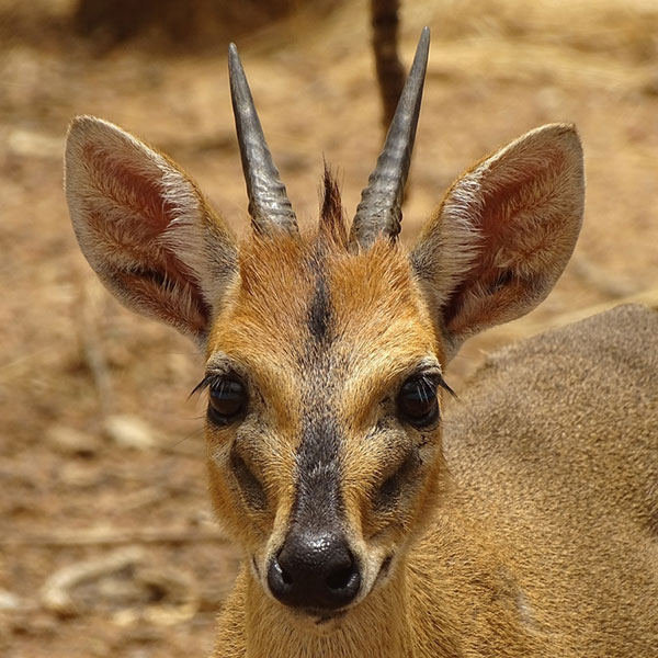
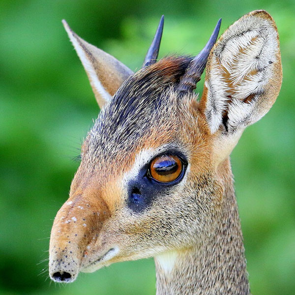
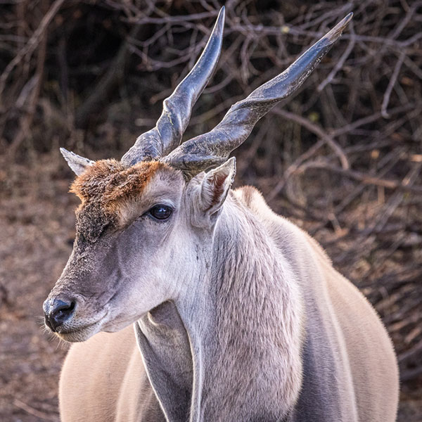
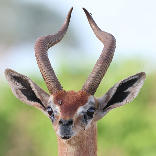
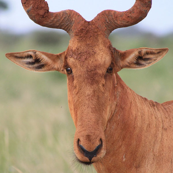
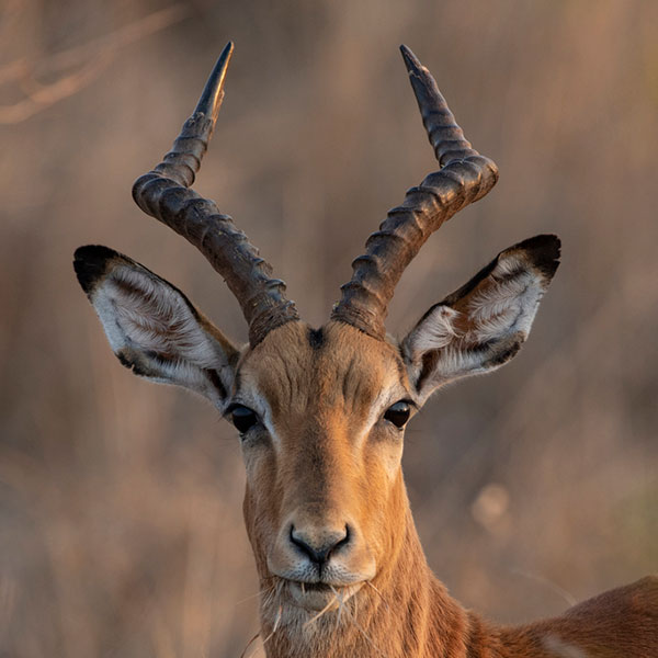
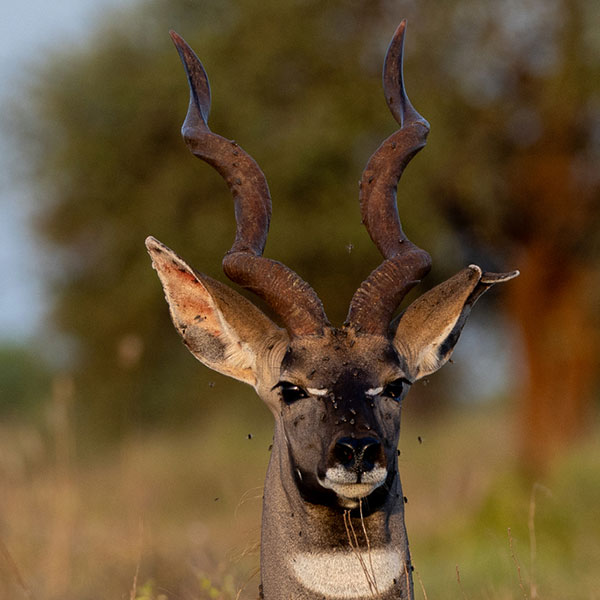
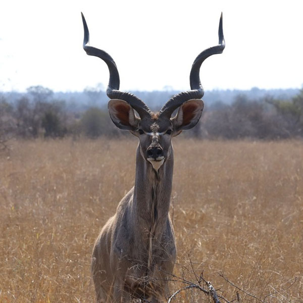
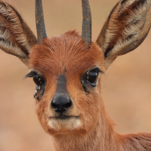
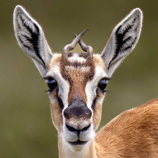
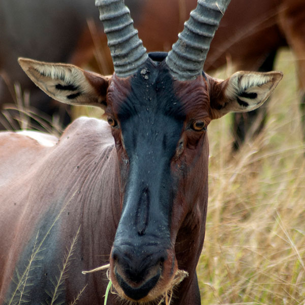
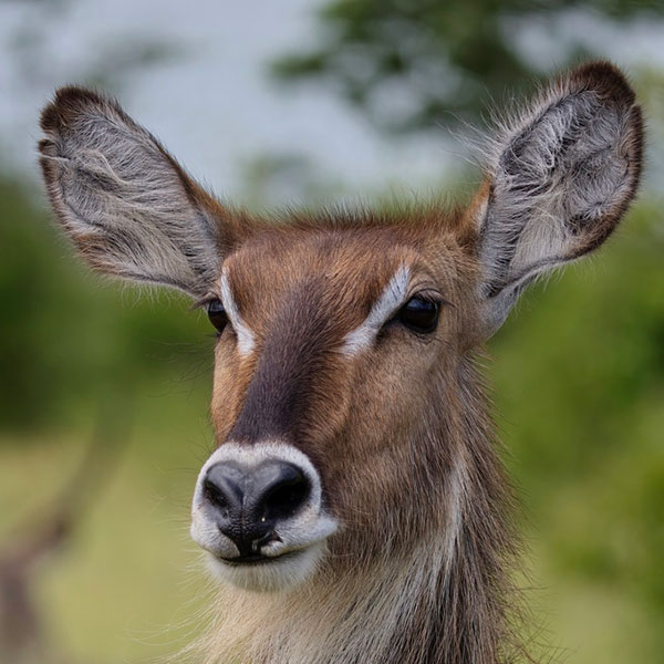
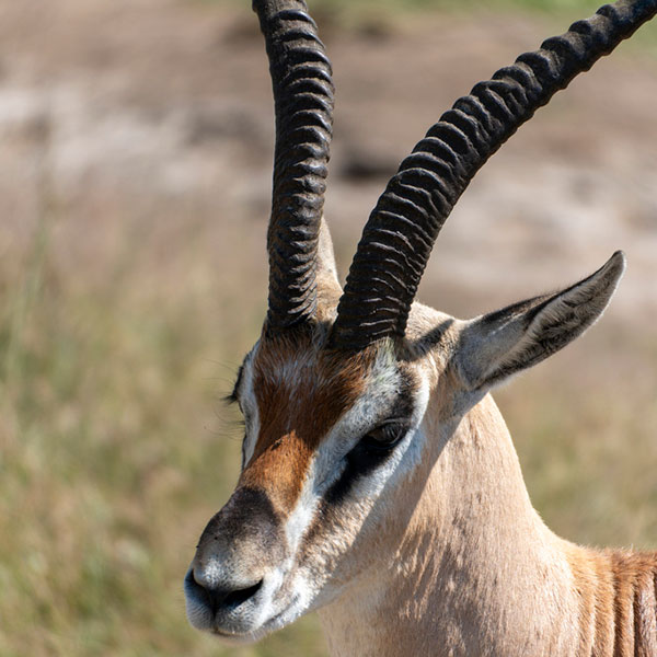
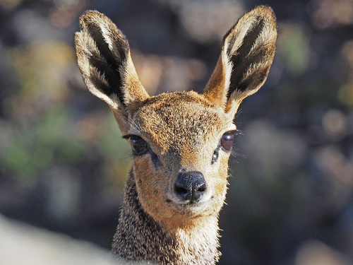
Antelopes of The Serengeti National Park
Meet the antelopes of Serengeti National Park.
Everyone knows about the wildebeests of the Great Migration, but what other antelopes can be seen on safari in Serengeti National Park? We introduce you to all of the antelopes, including some surprising characters you probably haven’t heard of before!
Antelopes: What, exactly, is an antelope?
Antelope is the common name for all members of the family Bovidae other than cattle, sheep, or goats.
What are Bovids?
Bovids are a family of hollow-horned ruminants, their common characteristic is their unbranched, non-deciduous horns (not shed), Horns are present in males of all Bovid species and in females of some genera, usually in large species. The horns are composed of a bone core covered with a keratin sheath which is never shed, with an air space separating these two layers. This unique horn structure is the only unambiguous morphological feature of Bovids that distinguishes them from other ruminants such as Deer.
So the name antelope is often used to describe many members of this family, but it is not a definable, taxonomically based term.
Worldwide, the Bovidae family includes 120 species, 84 of which are antelopes. This means that most of all the bovids are antelopes. The remaining are cattle, goats, and sheep. The diversity and abundance of antelopes sets Africa apart from all the other continents, its antelope heaven having 72 to 75 different species, and Eurasia has 12; the other continents have none.
The 9 tribes of African antelopes thus represent a diversity of bovids far greater than on any other continent,
The two sexes of very large antelopes are referred to as bulls and cows, while in mid-sized and smaller antelopes they’re usually referred to as rams and ewes.